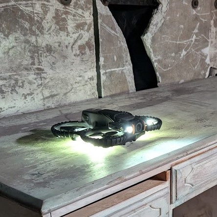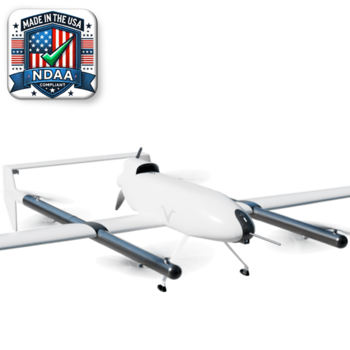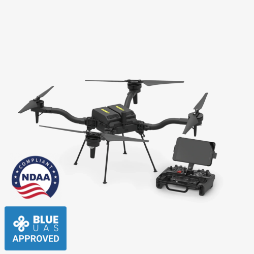

The Nightingale Security Blackbird Block-5
The Nightingale Blackbird Block-5 represents the latest generation of autonomous Robotic Aerial Security (RAS) systems. Building on more than seven years of operational experience and over 400,000 successful missions, the Block-5 integrates advanced imaging payloads, resilient communications, enhanced safety features, and extended endurance.
The Block-5 is purpose-built for protecting critical infrastructure, enterprise facilities, defense installations, and public safety environments. It enables autonomous patrols, rapid response, and persistent overwatch with minimal operator workload. Its NDAA-compliant design ensures supply-chain security and full alignment with U.S. and allied government procurement standards.
Features
- Engineered for DFR & Aerial Security – Emergencies can happen day or night, rain or shine. Nightingale’s Blackbird is designed to fly in rain, snow, light hail, winds up to 40 mph persistent / 45 mph gusts.
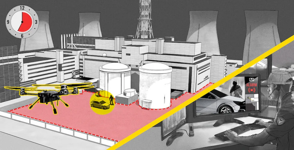
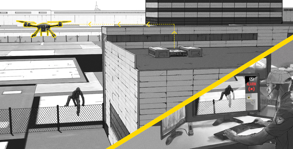
- Robotic AI Intrusion Detection (RAID) – Nightingale Blackbird Drones autonomously patrol facility perimeters and trigger alerts only when detecting human or vehicle intrusions—minimizing false alarms and maximizing efficiency.
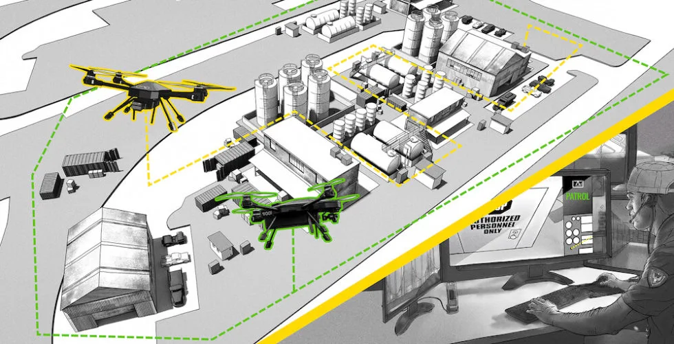
- Scheduled Autonomous Patrols – Pre-plan patrols by day, time, route, altitude, hover duration, and camera direction for consistent, repeatable security coverage.
- Autonomous Threat Response – When an alarm is triggered, a drone automatically launches, flies to the location, and streams live video back to security teams.
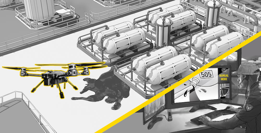
- Manual Surveillance Mission – Quickly deploy a drone for real-time monitoring during major events such as fires, chemical leaks, or oil spills.
- Always On Duty – With drones, base stations, and mission software operating 24/7, the system is always mission-ready—acting as a force multiplier for your team.
System Highlights
- Designed specifically for security applications
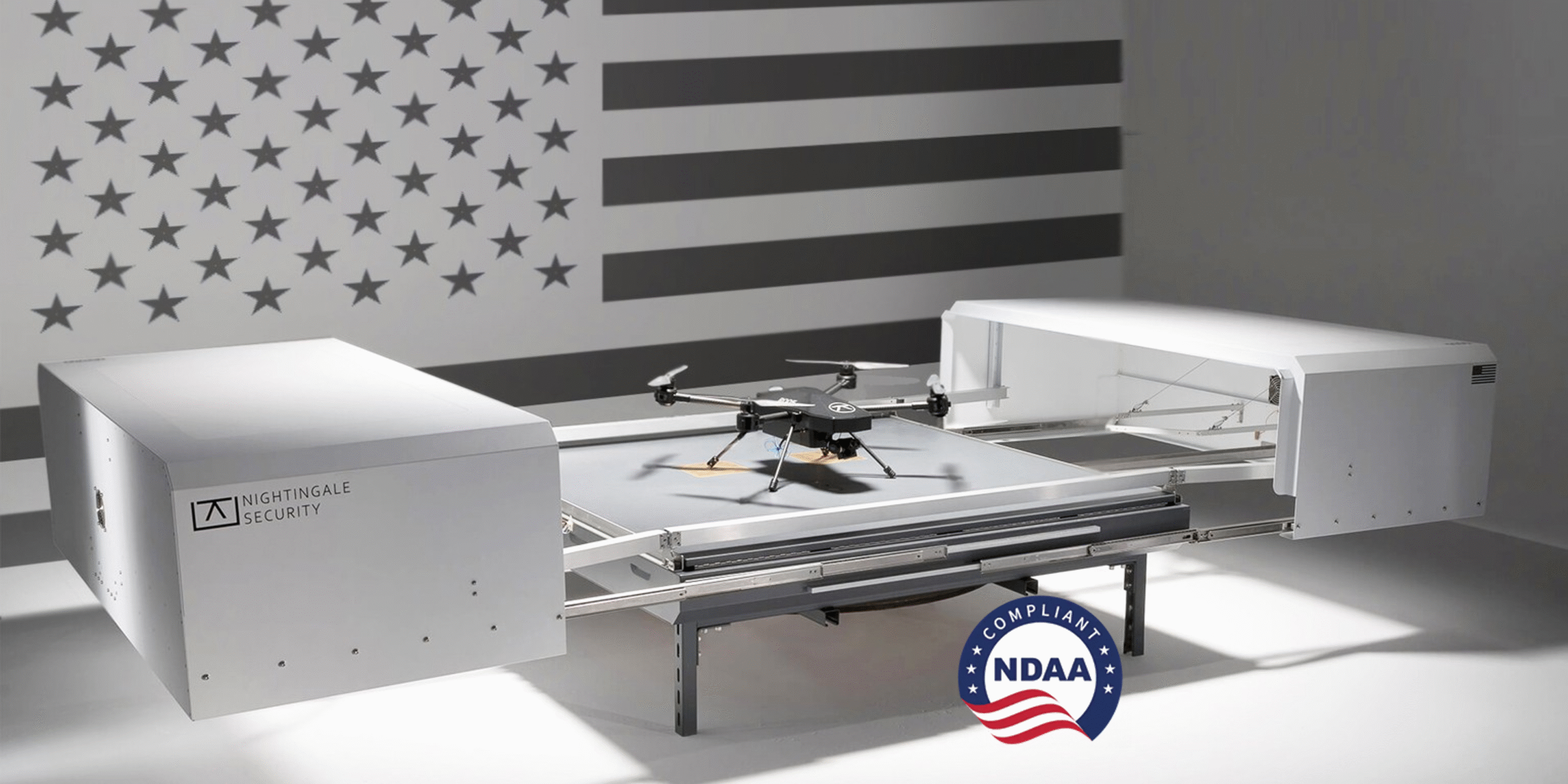
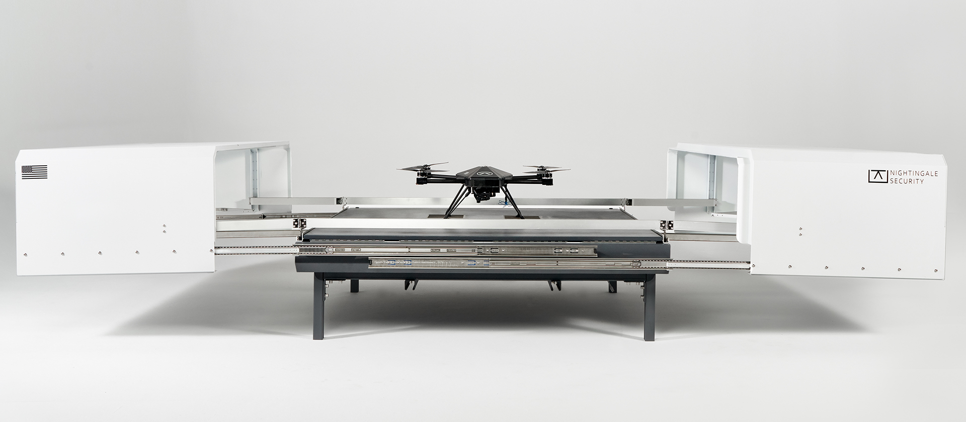
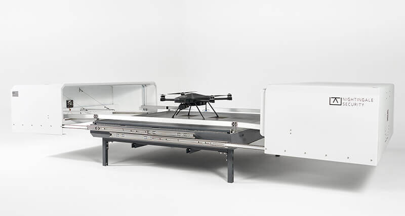
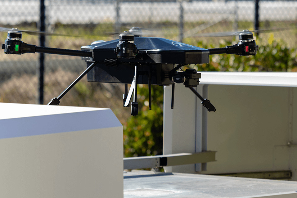
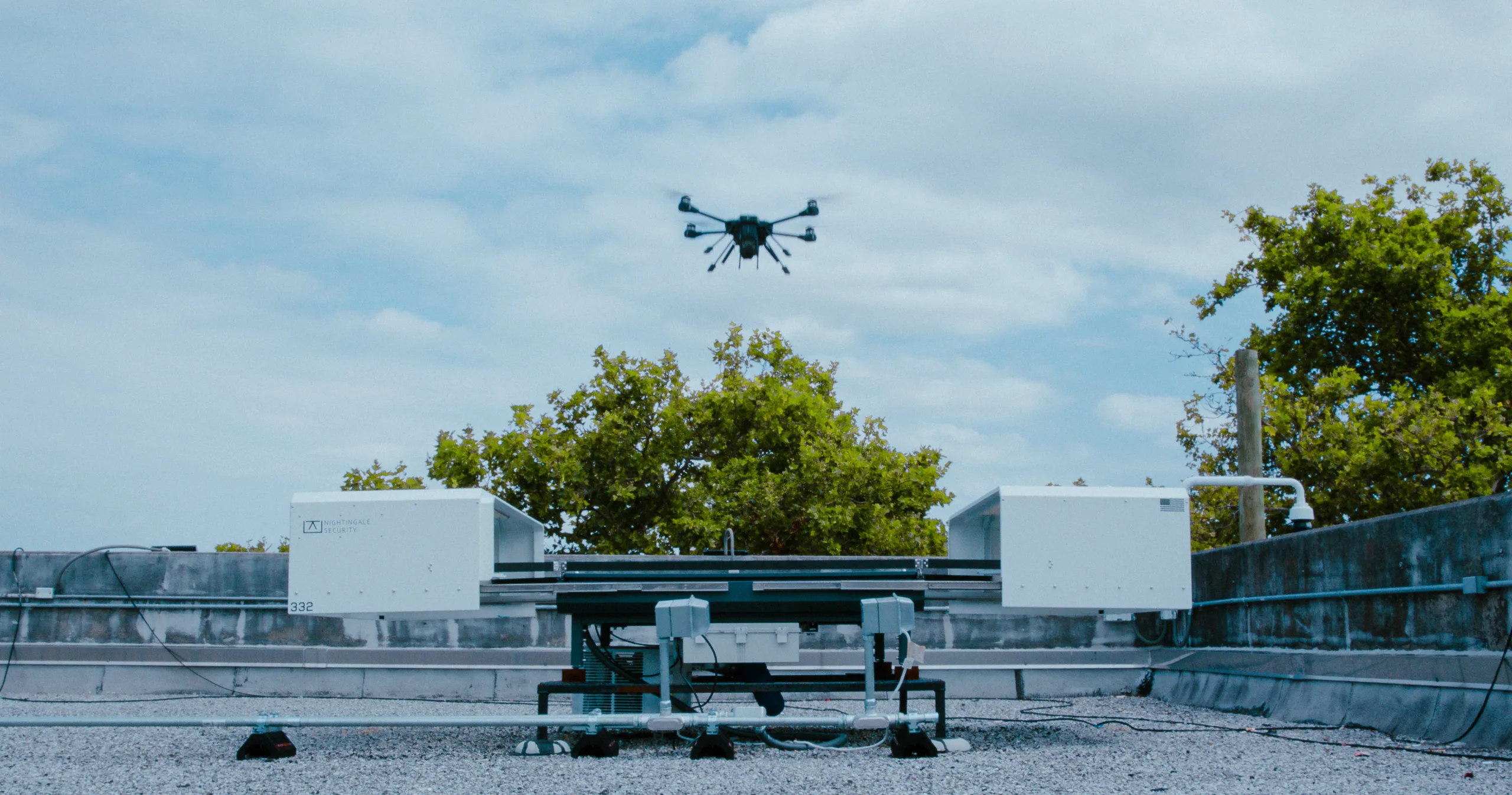
- Drone-in-a-box solution stationed onsite for rapid response
- Autonomous takeoff, patrol, landing, and recharging
- Pre-scheduled and on-demand missions
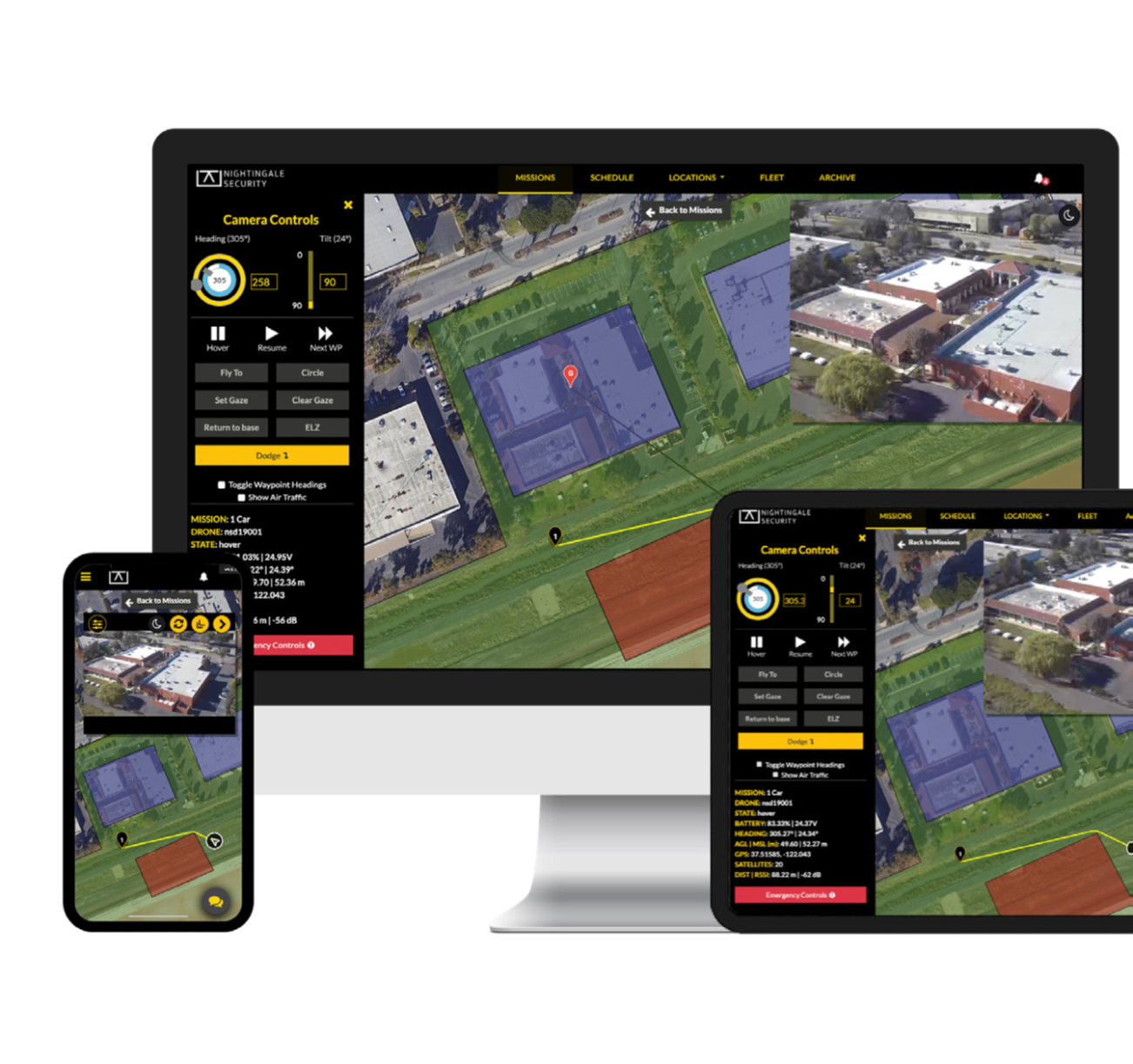
- Accessible via Mission Manager software on PC and mobile
- Live video feeds streamed to multiple users simultaneously
- Dual sensors (visible and thermal) for day/night operation
- Expandable platform for new applications
- Object recognition, tracking, and anomaly detection
- Drone-relay capability for extended missions
- Encrypted data storage with 24/7 access
- Seamless integration with VMS, alarm sensors, and alert systems
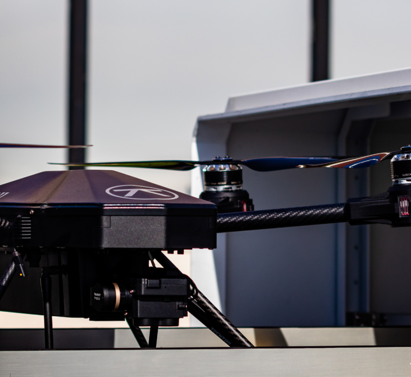
Drone Specs
Weight:
- 14.3 lbs (6.5 kg)
Dimensions:
- 25.3” × 30.6” × 11” (without props)
- 44.5” × 49.9” × 11” (with props)
- Height is 12.5″ with the parachute
Battery:
- 6-cell LiPo, 16Ah (22.2V nominal / 26.1V max)
Endurance:
- 45–50 minutes per mission (software governed at 25 min, adjustable by request)
Top Speed:
- 33 mph
Ascent/Descent Rates:
- 8 ft/s ascent, 5 ft/s descent (adjustable by request)
Wind Tolerance:
- 40 mph persistent, 45 mph gusts (software limited to 25 mph by default)
Operating Temp:
- 0°–122°F (extended to 140°F with heat-shield package)
Weather Tolerance:
- Operates in rain, snow, and wind up to 40mph; restricted in icing, hail, electrical storms, or dense fog
Camera Payload:
- Daylight/Starlight Wide 4K Camera: 60° HFoV
- Daylight/Starlight Zoom 4K Camera: 12° HFoV
- Equivalent resolution to 20X zoom on DJI M30
- Radiometric Thermal Camera: 640×512 resolution, <30 mK sensitivity
Collision Avoidance:
- Anti-collision strobe (>3 mi visibility), red/green navigation lights, intelligent path planning, ADS-B In (in development)
Data Security:
- AES-128 encryption
Range:
- 3-5 mile operational radius (depending on weather & network conditions)
Base Station Specifications
Weight:
- 265 kg (584 lbs) gross
Dimensions:
- Closed 62” × 66” × 32”
- Open 62” × 148” × 32”
Power:
- 1000W (standard)
- 2000W (with heater)
Edge Computing:
- CPU: Intel i7 10700TE
- RAM: 16GB DDR4
- GPU: NVIDIA RTX 3060
- Storage: 512GB SSD, 10TB HD, 4TB HD (expandable)
Nightingale’s Edge & Differentiators
- Edge Computing & Cybersecurity
- Secure edge platform: Data stored locally on base station
- Encrypted video & commands prevent cyber threats
- Trusted by US Army & critical infrastructure
- Focused on Physical Security
- 100% dedicated to security applications
- Expertise recognized by defense & law enforcement
- Continuous platform improvement
- Operational Experience
- 7+ years in security drones, 400k+ successful missions
- Redundant 4G LTE & proprietary RF communications
- Squadron operations for persistent surveillance
- Global & Extreme Deployment
- Proven performance worldwide, including Poland & Saudi Arabia
- Wide weather envelope & redundancy ensure reliability
- Military & DoD Trusted
- US Army & USAF approved for tactical ISR & perimeter patrol
- Real-time situational awareness as a force multiplier
- MRU & RaaS Model
- Robot as a Service aligns interests with customers
- Comprehensive maintenance, repair, and upgrades
- Extends system lifetime value
FAQ
What is the deployment process?
Deployment typically takes about two weeks. It includes site planning for base station locations, integration with existing power and security systems, facility mapping, patrol creation, staff training, system testing, and final commissioning.
Where do the drones take off and land?
Drones launch and land from Nightingale base stations, where they also recharge. In emergencies (e.g., sudden weather change), drones can land at designated Emergency Landing Zones (ELZs).
Where is the video stored, and how long is it accessible?
All video and flight data are stored locally in the base station. Customers can choose to keep data onsite, back it up to the cloud, or both—ensuring complete control over retention and access.
How long can the drones fly?
Up to 50 minutes in standard conditions. Flight time may vary depending on weather, wind, and payload.
How high can drones fly?
Typically up to 400 ft AGL (in compliance with FAA regulations).
Are there flight restrictions near airports?
Yes. Operations near airports require FAA airspace waivers. SOLID UAVS and Nightingale assists customers by assessing airspace and submitting waiver requests when needed.
How does the system integrate with existing security infrastructure?
The system uses standard IP camera formats compatible with most VMS platforms. Drone video streams can be easily integrated into your current security system.
How are missions programmed?
Using the Mission Manager web application, customers can quickly create, schedule, and launch missions with customizable routes and parameters.
What safety features are included?
Built-in safety measures include Return-to-Land (RTL) on error, geofencing to keep flights within boundaries, collision lights, and intelligent path planning to avoid ground hazards.
Can drones be flown manually?
Yes. Operators can manually dispatch drones to specific GPS coordinates and control camera orientation. The flight planner ensures obstacle avoidance and will approach as close as safely possible if a target location is unreachable.