
AirGuard
by AirSight
The Ultimate Airspace Security & Drone Detection Platform
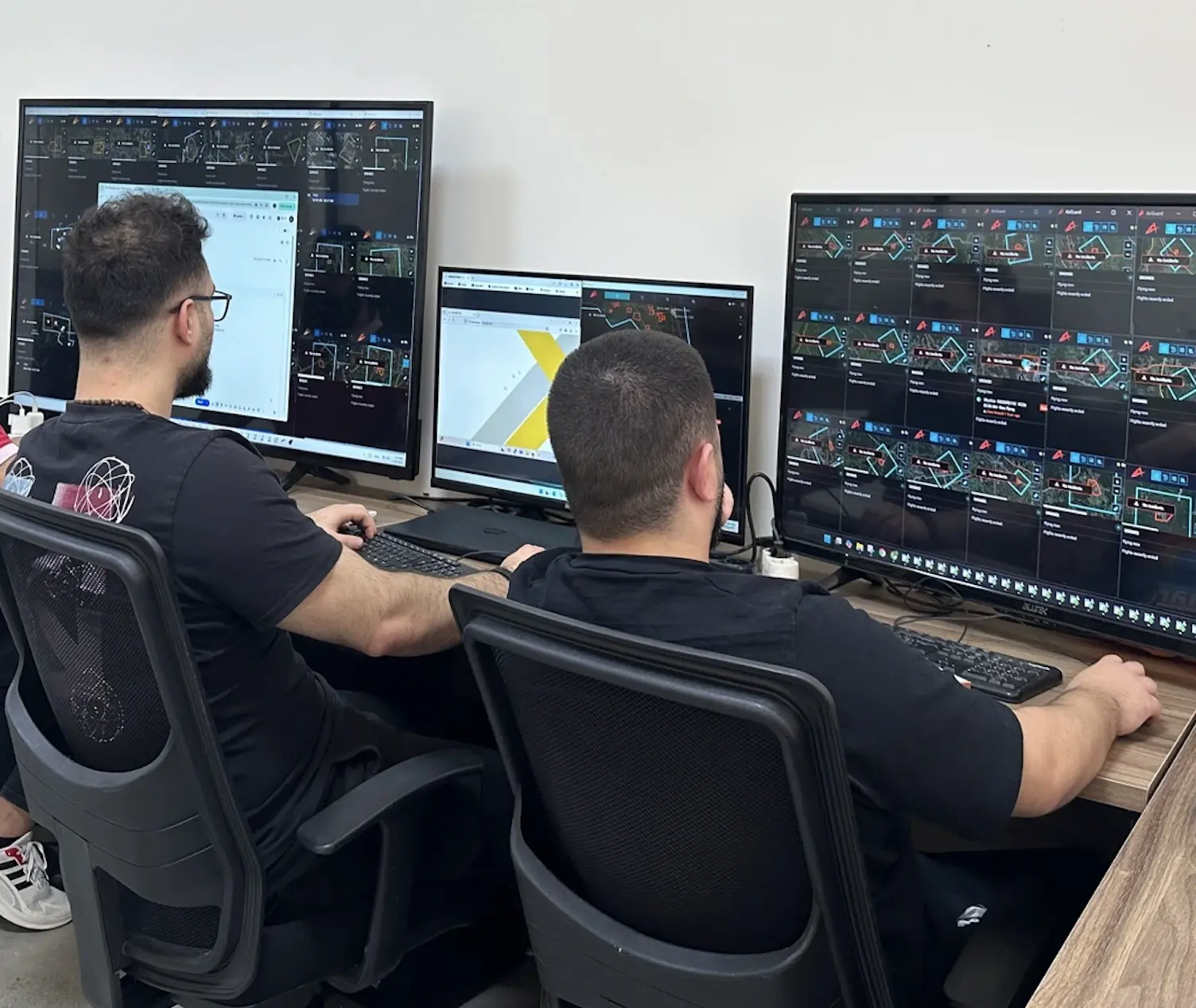
Take control of your overlying airspace with AirGuard, the industry-leading drone and drone pilot detection software platform from AirSight. Designed to bridge the gap between physical security and aerial threats, AirGuard fuses data from multiple sensor technologies into a “single pane of glass” to provide real-time, actionable intelligence.
Whether you are protecting an airport, a stadium, a correctional facility, or critical infrastructure, AirGuard empowers your security team to move from a reactive posture to a proactive defense.
Core Capabilities
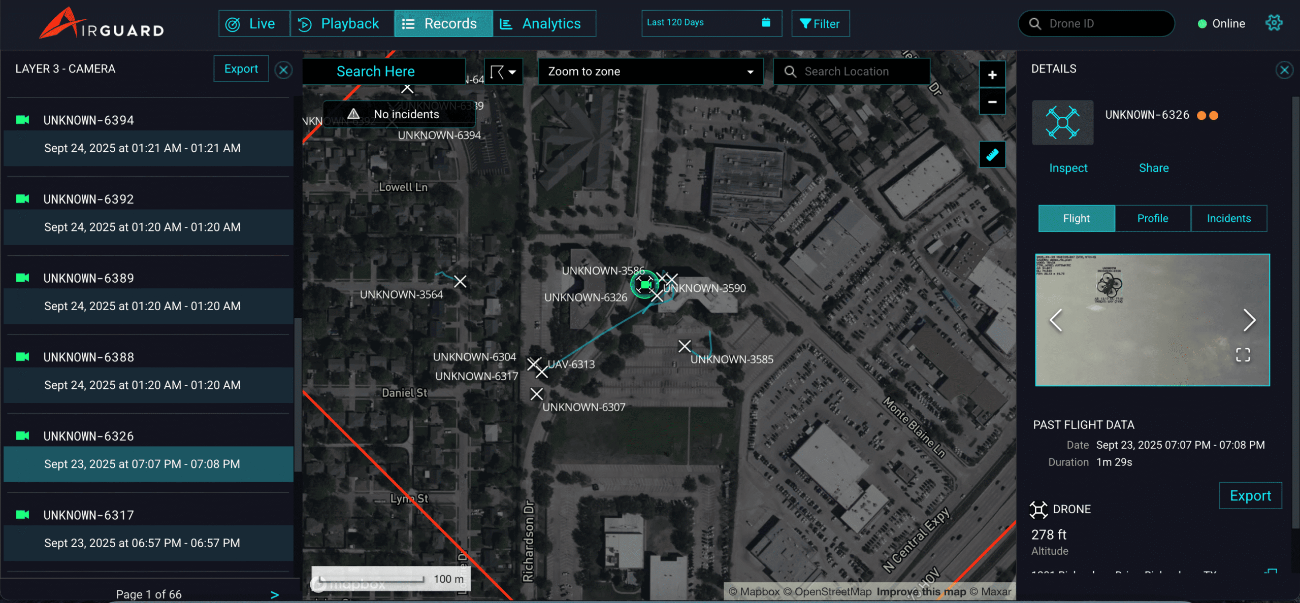
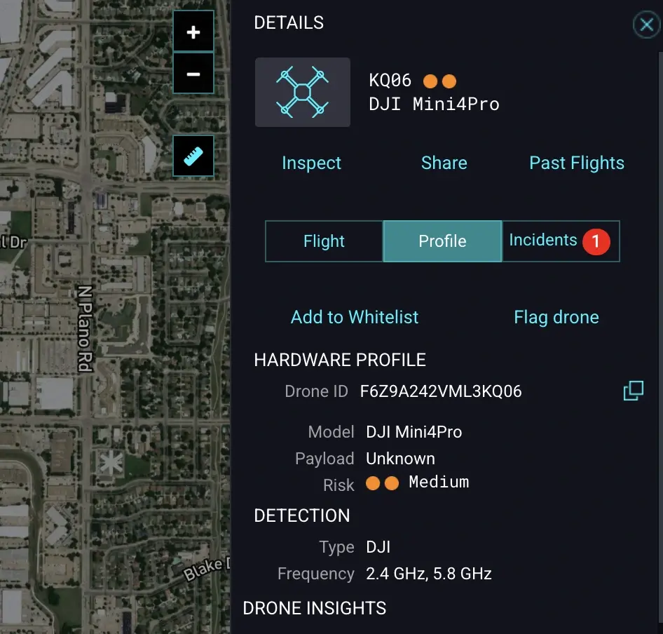
Real-Time Drone & Pilot Tracking
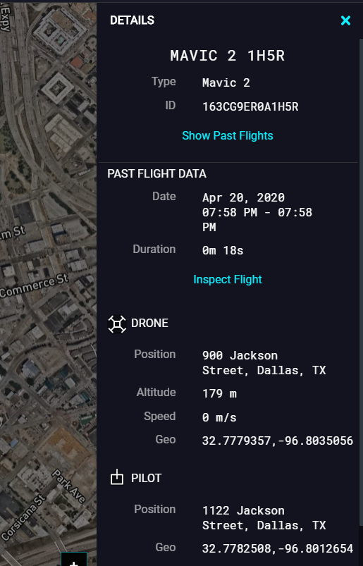
Don’t just see the drone—find the operator. AirGuard provides precise GPS coordinates for both the aircraft and the pilot, including altitude, speed, and flight path updates every 2 seconds.
Multi-Sensor Fusion
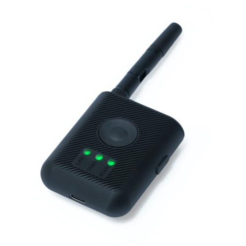
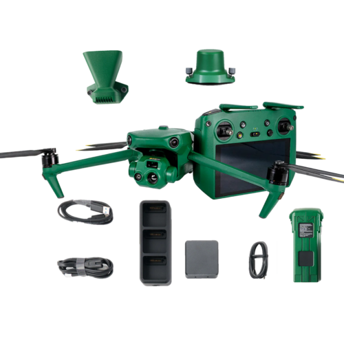
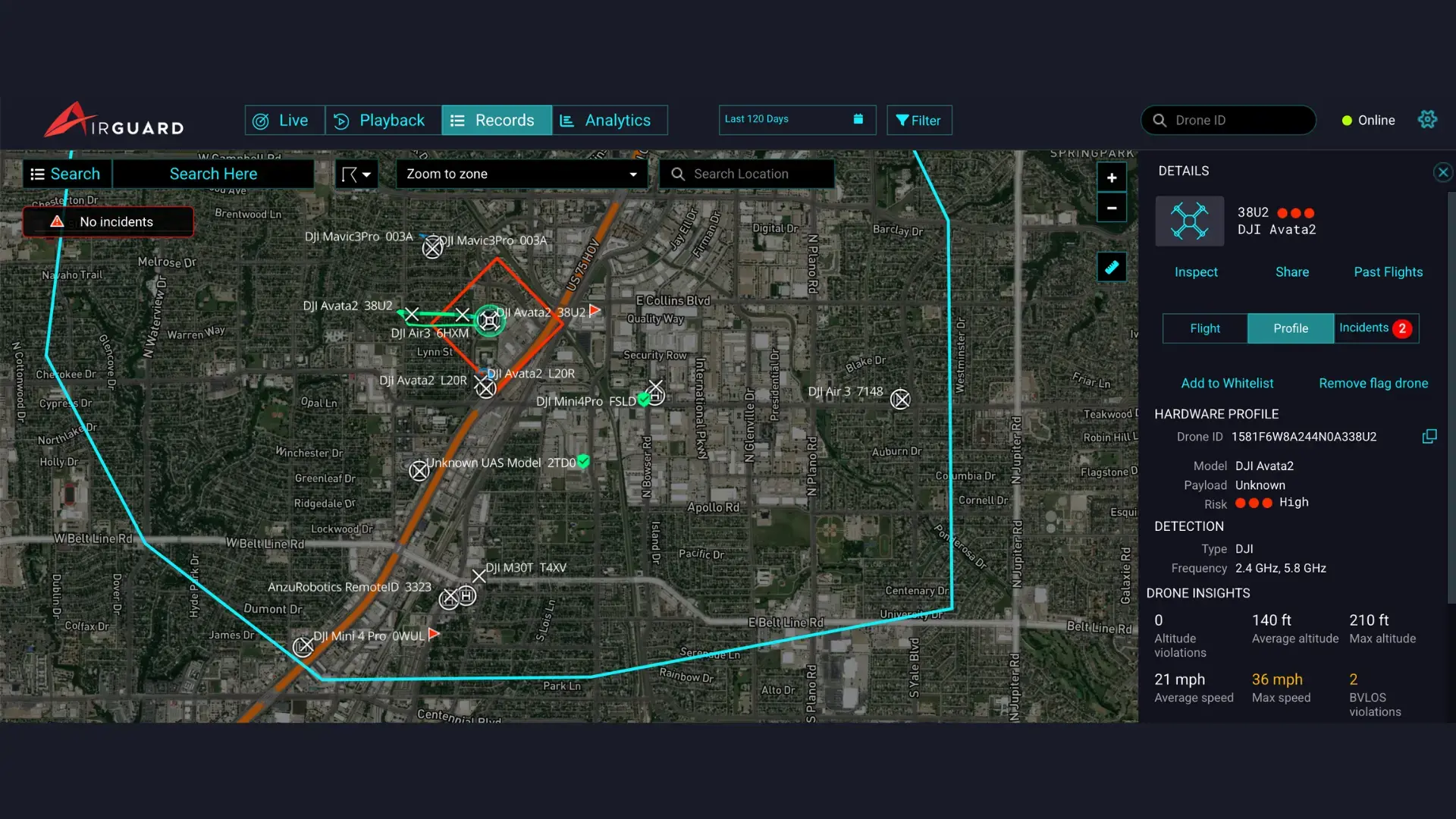
Seamlessly integrate Remote ID, Radio Frequency (RF), Radar, and PTZ Cameras into one intuitive interface. AirGuard’s open architecture is hardware-agnostic, meaning it can grow with your security needs.
Intelligent Threat Classification
Using AI-driven aircraft type classification, the system distinguishes between birds, authorized aircraft, and potential drone threats, virtually eliminating “alert fatigue.”
Forensic Evidence & Playback
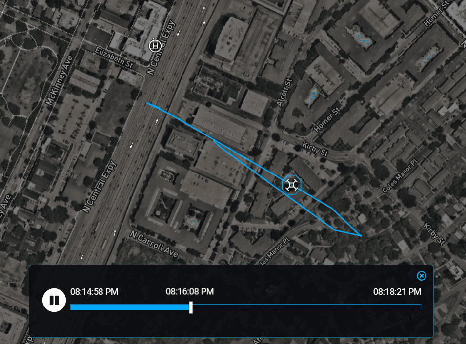
Access historical flight data. Replay any incident in minute detail, analyze patterns, and export video/data logs for law enforcement or regulatory reporting.
Key Features
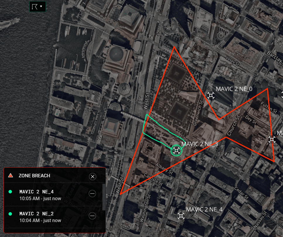
Smart Geofencing & Alerts
Define custom “Alert Zones” (e.g., specific blocks or perimeters). Receive instant notifications via SMS, Email, or Web Pop-ups the moment a drone crosses your line.
Whitelists & Blacklists
Authorized media or inspection drones can fly freely without triggering alarms, while known “repeat offenders” can be blacklisted for immediate high-priority tracking.
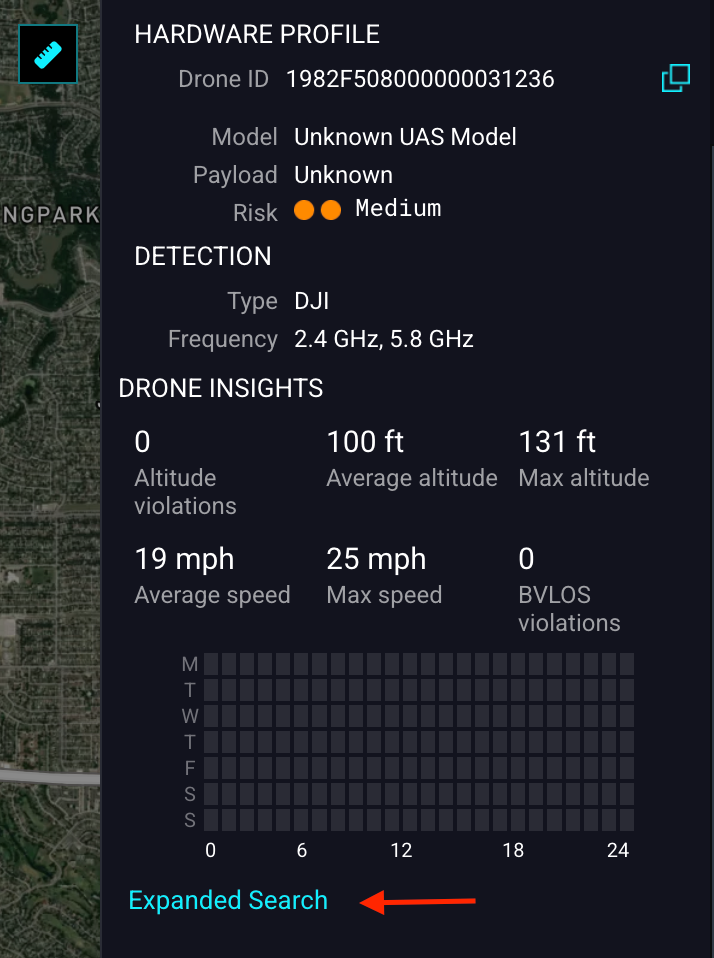
Nationwide Search Network
Unique to AirSight, administrators can query Drone IDs across a national database to see if a specific drone has scouted other sensitive locations across the country.
Automated Visual Verification
Integrate Axis PTZ cameras to automatically “slew-to-cue.” The camera will lock onto the drone’s GPS coordinates and capture high-resolution imagery for positive identification.
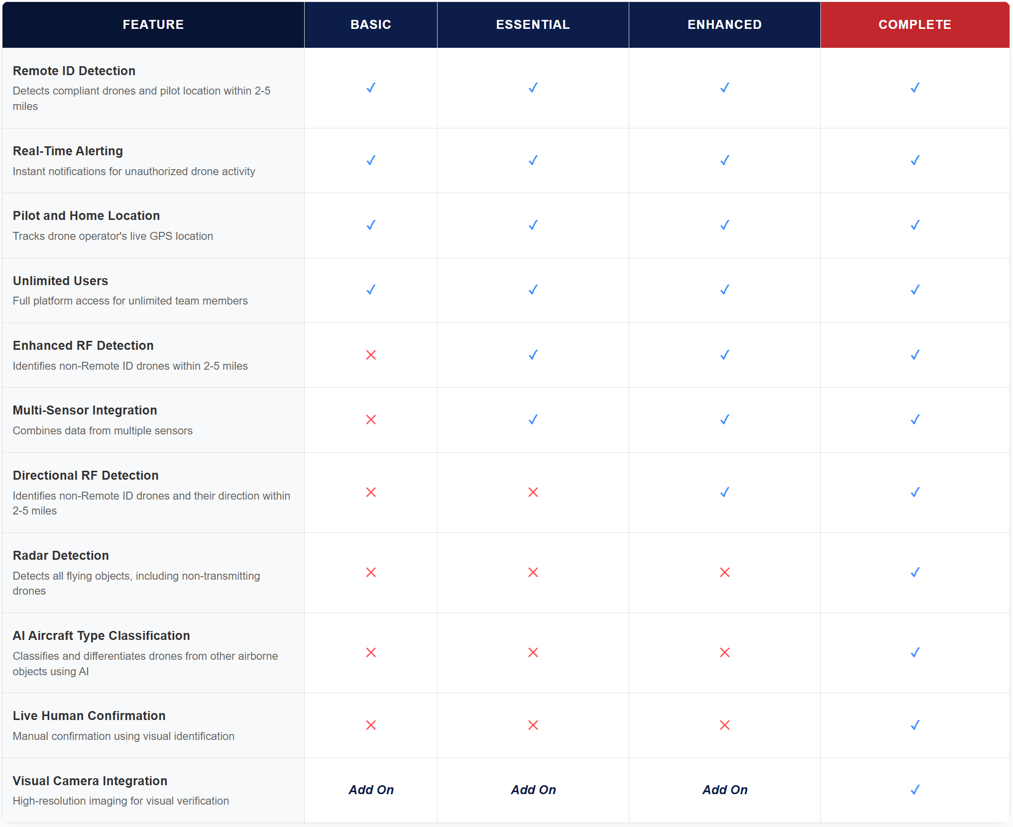
Tiered Protection Levels
AirGuard is scalable to fit your specific budget and threat profile:
Basic
Foundational Remote ID detection and real-time alerts.
Essential
Adds Enhanced RF for tracking non-compliant drones.
Enhanced
Adds Directional RF (DF) to locate “silent” or DIY drones.
Complete
The “Gold Standard”—integrates Radar, AI classification, and 24/7 human-in-the-loop monitoring.
Industries Served
Airports
Prevent flight delays and unauthorized incursions near runways.
Correctional Facilities
Detect and intercept contraband deliveries via drone.
Critical Infrastructure
Protect power lines, refineries, and data centers from espionage or physical damage.
Law Enforcement
Improve Day to Day security by tackling aerial drone threats.
Corporations
Protect against drones that can be used for surveillance, to gain competitive intelligence, hack or spoof networks, or cause damage to critical property.
Live Events & Stadiums
Ensure the safety of crowds by identifying aerial threats before they reach the stands.
Security
Provide an additional layer of protection for private estates and sensitive sites by neutralizing unauthorized drone surveillance.
Data Centers
Protect sensitive data against drones attempting to intercept wireless signals, map thermal signatures, or damage rooftop cooling systems.
Ready to secure your perimeter from the ground up?